 |
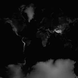
| terrain/0/0/0.png - the entire globe at zoom level 0 |
There is now a new GitHub public repository with heightmaps for the entire globe accurate to 90 meters.
Heightmaps are special image files where every color or shade represents an altitude/height/ elevation. They can help you create 3D cartography quickly and easily.
All of Jonathan de Ferranti's 3 Second data - all 265 gigabytes of raw binary files - have been losslessly compressed down to 2.85 gigabytes of PNG files. The files are organized in the Open Street Map way - according to the TMS standard.
The files are in the GitHub pages branch so you are free to access these files from your app or use them as you wish. Everything is under an MIT license.
And and as free bonus, Ferranti's 15 Second data is also up and available as well.
All of this is documented and described - including the tricks being used - here;
Jaanga Terrain as GitHub Pages
Jaanga Terrain as GitHub Source Code
There are also links to demo files to show you how JavaScript and libraries such Three.js can be used to view and manipulate the data.
And, if we weren't so busy with all the viewers, we would be working on the One Second data - accurate to about 30 meters.
Thank you Jonathan de Ferranti, GitHub and Mr.doob for making all this possible.
No comments:
Post a Comment